STAHL SHEAFFER ENGINEERING
  • Home
  • About
  • News
    • Press
  • SERVICES
    • Bridge | Tunnel
    • Building Structures
    • Construction Inspection
    • Geotechnical Services
    • Site Engineering
    • Survey & Reality Capture
    • Transportation
  • MARKETS
    • Academic
    • Athletic & Recreation
    • Municipal Services
    • Private Development
    • Public Agencies
    • Energy
  • CAREERS
    • Survey Project Manager
    • Building Structural Intern
  • Locations
  • INVOLVEMENT
    • Community
    • Associations

Landfill Stockpile Aerial Survey

Private Client, Wheeling Landfill, Wheeling, WV

Landfill Stockpile Aerial Survey.pdf
File Size: 668 kb
File Type: pdf
Download File

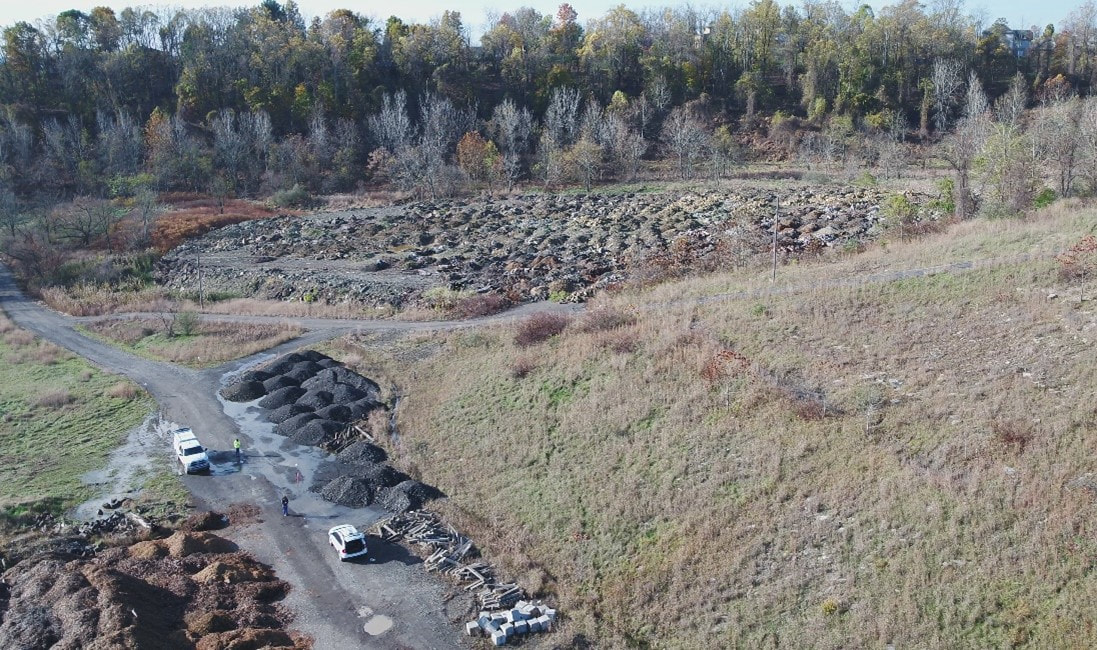
Stahl Sheaffer conducted a supplemental topographic survey for the closure of a landfill. The landfill is approximately 11-12 acres and consists of waste soil, rock, construction and demolition debris, woody debris, asphalt millings, etc. The last time this area was mapped was in 2010, and since then various sources of material have been hauled in for disposal at the landfill area, in some cases exceeding the limits of the project. Much of this material remains in piles. This survey was needed to help establish current site grades, identify material, and estimate site earthwork volumes.

Drone Flight at Landfill Stockpiles from Stahl Sheaffer Engineering, LLC on Vimeo.

Picture
Contact Us
  • Home
  • About
  • News
    • Press
  • SERVICES
    • Bridge | Tunnel
    • Building Structures
    • Construction Inspection
    • Geotechnical Services
    • Site Engineering
    • Survey & Reality Capture
    • Transportation
  • MARKETS
    • Academic
    • Athletic & Recreation
    • Municipal Services
    • Private Development
    • Public Agencies
    • Energy
  • CAREERS
    • Survey Project Manager
    • Building Structural Intern
  • Locations
  • INVOLVEMENT
    • Community
    • Associations